
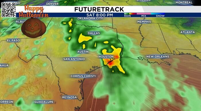
Early Look:
Over the past day and a half, the major computer models have started to trend towards a rainier and cooler Halloween for southeast Texas this year. We are still ten days out and plenty can change, but the trend is moving in a wetter direction. Right now, we’ll keep rain chances lower because it’s a ways off, but it would be a good idea to go ahead and make contingency plans for Halloween, should rain pop up. A few thunderstorms are also possible, with the best chance coming along the coastline and points south, but an isolated chance exists for everyone at this point. We’ll be able to pinpoint more details as we get closer.

The temperatures look to be cooler, as a result of both the possible rain present, and some cooler air making its way in by Saturday. Overall, I would expect it to be cooler than normal, but not cold. Again, this is subject to change, and we’ll have more detail as we get closer next week.

Bottom Line:
Computer model data gives us trends, rather than just a snapshot or one moment in time, as you may see posted on social media. The major models update every 6-12 hours in most cases, and we analyze, interpret, and accommodate for their respective biases. Due to the increasing trend of the major models to more of a rainy/stormy pattern for next weekend, we’ve added chances and are letting you know. But this is still far enough out for a wind window of uncertainty, and things can certainly change. At this point, have a few plans in place so you can enjoy your Halloween, and stay apprised into next week!


